Saturday, December 11, 2010

Hoilday Cheer

The annual Charleston Christmas Boat parade as seen from our pilot house


What was fun was the hooting and horn blowing as each boat passed by

Thursday, December 9, 2010

Finally an update

I admittedly have done less than a yeoman's job in keeping current with blog entries.  Having followed others I find that not keeping up is frustrating and after a while I stop checking. Not wanting that to happen I will try and keep this up with maybe a bit shorter on the  posts than in the past.

After a delightful Thanksgiving at home with Billy and Johnny, where we fried a turkey (a first) and over ate. Jeannie and I drove back to Isle of Palms and moved the boat to Charleston City Marina http://www.charlestoncitymarina.com/ , where we will stay for the winter. A bit chilly perhaps but a remarkable city which we hope to explore and enjoy. We are on the "mega dock" and you can find us using their web cam http://www.charlestoncitymarina.com/web_cam.html
 If you look to the south end of the mega dock we are a third of the way in from the entry on the inside portion of the dock.

More latter...

Thursday, November 4, 2010

So much for that plan

There was a plan when we departed....Then....?
Our plan was to travel from Morehead City/Beaufort NC to Wrightsville Beach via the ICW. On this day that meant four bridges whose timed openings are, hmmm shall we say, difficult, two at the half hour and two on the hour. The problem is we can never and have never been able to time our arrivals well, and end up waiting, which adds a lot of time to the trip.

From there onto Myrtle Beach, Georgetown and then Isle of Palms Marina where we will keep the boat for the month of November.

As we were pulling away from the dock;

He says..wow the weather looks great and the near shore and off shore forecast seem really fine
Why don't we run off shore to Masonboro Inlet at Wrightsville and skip all of the bridge hassles.

She says; agreeably, sure.

We headed out Beaufort Inlet, pass the markers to Beaufort and out the channel to the ocean.

There was a steady line of boats headed out because of the good weather forecast. In front of us was a Kadey Krogen named Steadfast and a sports fisher.

This is a popular exit point for boats heading south via the ocean with many running to Fla. or the Bahamas. Once past the inlet I reworked the route to Wrightsville Beach via Masonboro inlet.


We are out in the ocean for about and hour and...

She says: It is so nice out here why don't we travel all the way to Charleston Harbor and cut out Wrightsville Beach, Myrtle Beach and Georgetown SC. It will only take 26 hrs or so......

He says; nothing, in the background he is.....

(editors note; In the boating community it is not uncommon for him to be referred to as Captain and her, to be referred to as the Admiral. I, however, never use these terms because I think they are contrite and condescending. However it is important to look at t the actions and not the words in this case.)


....on the cell phone (we are still close enough to get a signal) ...yes we can get a slip at Isle of Palms Marina but don't show up before 10-11am (yikes)and yes we can cancel our reservations to the three marinas along the ICW without any problems.
Time on phone 10 min.

He sets about to calculating the route (distance) to speeds get to the correct arrival time (distance = speed x time). There are actually three different speeds and segments that need to be calculated.

First; We will go through Frying Pan Shoals, well named,we would like to do that in the light, from our starting point to the exit way point at the of the shoal, we will go 9.3kts burning 10g/hr.

Second; From Frying Pan Shoals to the first entry buoy to Charleston Harbor traveling at 7.0kts burning 4g/hr.

Third; From Charleston harbor, adjusting for current, to Isle of Palms Marina but not adjusting for the Ben Sawyer Bridge.


She smiles; as he is totally geeked out with his gizmos, programs and calculations

Total trip 200nm and 30 hours

Time spent calculating it 20min


We had a bug hitching a ride and he was quite happy with the notion. But this does not address the ADD issues with the time spent taking the picture vs working on the navigational problems; add 5 min.

He thinks: why that would be great, we would save buckets of $$ by not staying at three marinas, use less fuel and get there a couple of days sooner. What is not to like?
He says finally: Sure that makes sense.

She says, smiling; fine let's do it


Total time  elapsed; 35 min, way geeked out and in his own world at this point. Those USCG Captains course sure came in handy he concludes.


We begin our first off shore cruise of the season without the usual pre-trip planning of the most anal retentive type. But truth be told all of our maintenance and safety work is current and complete. We have enough fuel to go over 2,500 nm. With the exception of a Float Plan that we usually let our family know of our course and way points lat and long we are now too far off shore for cell phones to work but we are in great shape, plus we have our Spot tracker on and broadcasting ( http://share.findmespot.com/shared/faces/viewspots.jsp?glId=0YbgAe68AMPZoLxpBHQYaVI86IlerZvb3 ) note this will give only our current position.


We had heard on the marine radio several boats talking about going overnight to Charleston Harbor to take advantage of the weather window so we hailed them and joined into the group. Steadfast, Summer Ski's, Oasis, Almost Perfect and Seabright for a total of five boats making an overnight run to Charleston Harbor. We have gone overnight many times before but never with others and never in a long train. So we all coordinated our way points and communications and lined up and took off.

After all of the hub-bub is done I recall why I do not like these.

Boring! I did not plan on this so I did not have my usual audio book and I cannot read a book, ohh motion sickness, I will try to busy myself as best I can for a long run of 30 hours.More on this later...

We share watches of 3hrs on 3hrs off and at night 2hrs on 2hrs off.....but in reality I do not sleep well.I have a hard time staying away form the pilot house or fly bridge, depending on where we are running from and as a result I have a hard time turning it off when it is time to sleep.

A comment about motion sickness, if the seas kick up I can be affected. I can take medicine but do not like to do so because the side effects can be worse than the cure. What I have found is staying busy and occupied is better than just watching the instrument panel and letting my sight drift around. One of the best ways to do this especially in a dark pilot house at 3am is to listen to an audio book. This somehow keeps me focused on the book and my attention stays focused. For most people it takes about 3 days for your brain and inner ear to reorient itself to the motion. After some time on the boat going ashore still gives you the sense of motion for a time.

Jeannie however is not affected at all! Truth be told there was one episode when we were traveling to Bermuda and were in 8-10 ft seas on the bow, she was sitting in the pilot house doing a crossword puzzle and had a momentary pang of discomfort. She put the puzzle aside and immediately felt better, poor baby. By the way she is a purist and only does these puzzles in ink.

Last time I had a great audio book and was very entertained during a late night run. Jeannie lent me her IPad and I listened to Car talk with the Tappert Brothers, Click and Clack pod casts, through out my night watches...turned out to be really quite entertaining.

A brief comment on Seabright; we have an active fin stabilization system that is hydraulically driven with power take offs from each engine so the system has built in redundancy. This system also powers our bow & stern thrusters as well as the anchor windlass. At sea the active fins  move to counter roll and as a result about 96% of the roll is dampened. Quite comfortable, it is made by ABT Track (  http://www.thrusters.com/products/hydraulics.shtm ) . On her own Seabright is very stable, dry and handles the waves well. Less pitching and dryer than our last boat.

The way the shore line curves away from our straight line course way point to way point we end up off shore by 70-80nm and well out of cell range and most other things for that matter.
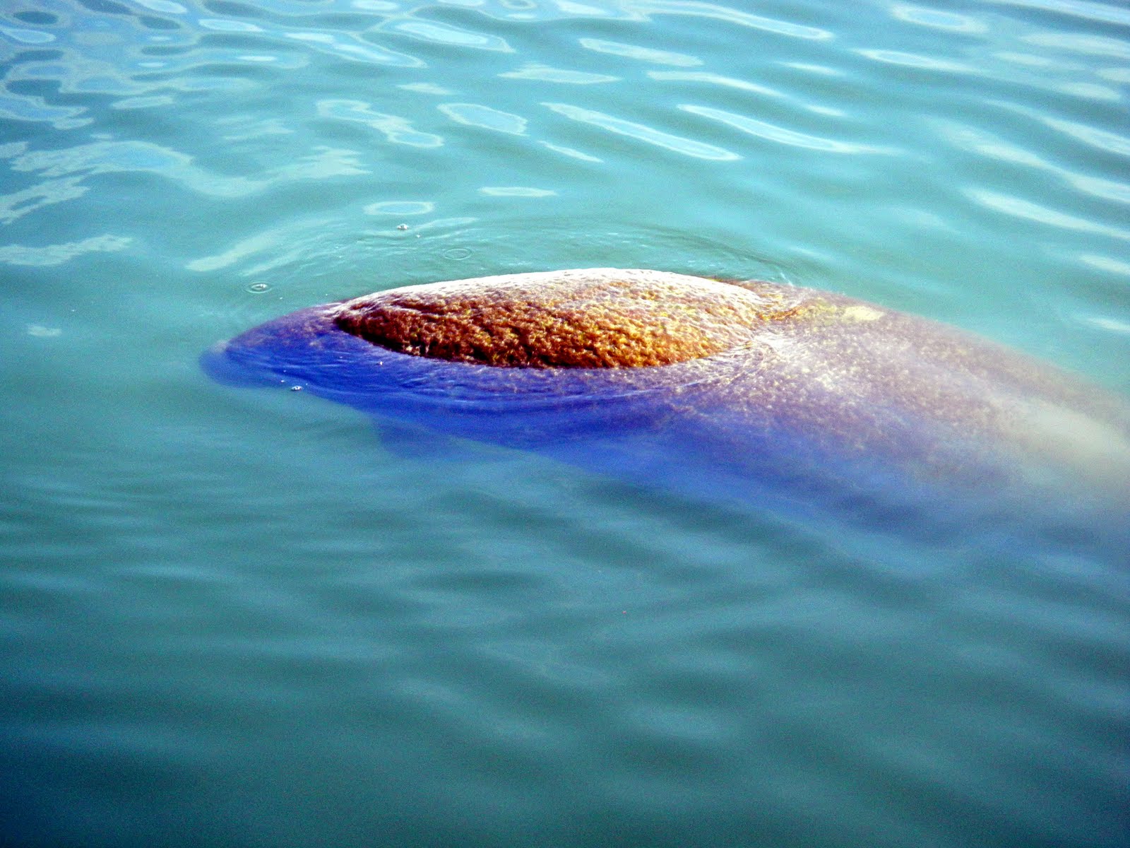
The color of the water is quite different and we tried to capture the clear blue color in the prop wash
We arrived at the channel right on time and began our entry. We followed a shrimp boat returning with it's catch along with hundreds of birds. On the background you can see Fort Sumter.

We turned north from the Charleston Harbor to go up the ICW Isle of Palms Marina which is another 5 statute miles. Saying goodbye to our new friends from the overnight run.

We have a bridge clearance of 45ft with our antenna up and 30 feet with them down. The Ben Sawyer Bridge  has a clearance of 32 ft which we can clear with my antennae down and they will not lift if it is only your antenna which prevent you from going through. So we have a bit of work to do. We stopped a half mile short of the bridge and I shimmied out on the sides near the boat deck and dropped the antenna while Jeannie piloted the boat keeping her straight in the channel with a 2 kt current.

We arrived at 10:30am and backed into our slip. A bit of a current was running so I needed to go in, turn and come at the slip against the current for better control, but essentially without problems.

Tuesday, November 2, 2010

Alligator River; Turn & Bump

When we travel, like many others we use a form of both electronic and paper charts as well as updates of the ICW from various sources.
Conditions are constantly changing as weather wind and tides have their way. But there are sections of the the waterway that have developed a "reputation". The one pictured here on our electronic chart is a great example. Typically the ICW route is highlighted by way of a  "magenta line". Boaters of all types follow it, in some cases to a fault.
On this passage from Albemarle Sound to the Alligator River it can be tricky for the unaware.
On the chart is a jag & turn to the starboard when traveling south as you can see from the green 7 to the white channel. The problem with this course is the water is very shallow down to 3 ft or less. Ouch! On the chart I put in a short course that went straight, marker to marker.   Traveling north last Spring and again recently, two boats (each time, one a motor and the other a sail) had run aground.

Later that same day at markers 35 on the Alligator River there were large tree trunks in the water. These are called "deadheads" and if you bump one it would ruin your day. Always best in these waters to keep a good watch.

You can see a white caption box which gives the details of the hazard, this is available on Active Captain; http://www.activecaptain.com/X.php . We also use computer based software for our chart plotter called Maxsea; http://comen.maxsea.fr/maxsea/ . An excellent program.

Thursday, October 28, 2010

Pulling up anchor

For as much fun as anchoring can be, there is a dark, smelly and dirty side.

To start with, the rule of thumb in how much scope to put out (scope is meant in this case chain or rope you set out) is 5-7 ft of chain for every one foot of depth. Our depth at the North Pungo River was 10-12 ft so the rule would imply that we deploy 70-84ft of chain plus the height from the water line to the anchor roller on the bow which adds an additional 8ft.

For us the chain acts as a safety measure. In the event the anchor breaks free the weight of the chain will pull down on the flukes and reset......We typically deploy about 110-120 ft of chain as an additional safety measure. As an aside we put out snubber lines. These are 2 ropes that attach with a connector to the chain on one end and then tie off to the boat through 2 hauser holes port & starboard. The reason to do this is to transfer the stress of the chain to the snubbers and off the anchor windlass. The windlass is not built to take the pressure of the chain snapping when the wind blows or when currents tug. Snubbers act then as load transfer shock absorbers. For completeness we have a large Rocna anchor, which is 121lbs. Our windlass is upgraded to vertical Maxwwell 4000 with a band brake, which is hydraulically powered.

So..the dark and dirty side you ask? Pulling it all up and hosing it off as it comes aboard after sitting in the muck. The north Pungo River has great holding, in that our anchor buries itself into the bottom and does not budge. But it is black, smelly, oozy mud.

We set up a hose on the bow and pull in 5-8 feet of chain at a time, hosing it off as we go and trying to stay out of the smelly spatter from the spray, while at the same time being aware of where the boat is and what the wind and current conditions are doing to the doing to the boat.

We control the windlass with a wired remote control and Jeannie and I wear wireless headsets. One of us is on the flybridge controlling the boat and the other is on the bow with the windlass controller in one hand and a hose in the other.
So how does this play out in real time?

He says: Ok I am going to start, you hear the sound of the windlass and hose
She says: ok do I need to do anything?
He says: damn this stuff stinks and is like black Elmer's glue, move the bow to the starboard a bit
She says okee dokee
He says: move the bow to the port....er I mean starboard, wow this stuff is a mess.
She says: nothing, being the smart lady she is
She says: you have 90 more feet to go and starts giving a 5 ft count down
He says: yuk this &^#(%@ stuff is &^^%$# awful

You get the picture.

Tuesday, October 26, 2010

The good Life at Coinjock NC

 Coinjock NC is just one of those places. It is ideally situated from Portsmouth Va by 50 statute miles. Given bridgeslocks and slow speeds, it is a very common first stop south along the ICW. It is really no more than a wide place in the water, but we do like it. Side ties, good service and a great restaurant, What more is there? Talking with the dock master, they have been full for several weeks and the day we were there was no different. We were sandwiched in between two 90 footers. The dock had all sorts of boats from the really large with multiple crew members to some you have to wonder if they will float for much longer. The mood is generally upbeat and friendly as folks mix it up in the dock, wash the boats  take on fuel and generally ruminate about worldly issues such as the weather, tides and each other. All in all my kinda of place.  We always see such an assortment of boats that leave Norfolk & Portsmouth that will soon spread out, but for the moment, all still scrunched together. We hailed this fellow on the marine radio to coordinate us passing them ( they are going 6 kts, we are going 8.5 kts, we are quite the speed demon). As we are going by Jeannie hails them to let them know we think their boat is pretty and would like to take a picture, the crusty captain calls back and says go ahead but let him pull his zipper up first. You really cannot make this stuff up.

We love fresh wild caught shrimp so it is always fun when we start seeing the shrimping fleet. This ole girl we saw last year.
 Our next destination is an anchorage at the end of the  Alligator-Pungo Canal, in the north Pungo River. A quiet and serene place with good holding and protection from the wind from all directions except maybe the south. We dropped our anchor in 12 feet of water and put out 110 ft of chain and deployed our snubbers. Then we had a great dinner, fine drinks and enjoyed  the solitude.
 There were 5 other boats in and around the area as you can see a few here. There are no lights from cities or homes, just marshes and woods.
This night we had a full moon which gave the place a special feel. Ahhhhh!!

Monday, October 25, 2010

And they are off

This is the boating snow bird season and, like in the past, this fall does not disappoint. Many many boats are headed south and the flock is certainly raring to go.

 This is the official start point. The ICW begins at red marker 36; mile zero. There are 5 bridges and one lock which, with the exception of one bridge, will open either on the hour or half hour. The typical start time is to be at the first bridge for the first opening: 8:30am (closed during rush hour) opening and plan on traveling in a group from bridge to bridge.  There were 6 motor boats and 6 sail boats in the group we traveled with. A group behind us had 18 boats.
 Norfolk and Portsmouth are quite industrial and support both large commercial shipping and the US Navy, quite the sight.


 Near our home on Indian Creek in Kilmarnock Va, there is a grain silo for shipping the local farming crops, mostly soy beans and field corn. It is a common sight to see tugs and barges coming in empty and leaving full. This is where they go. If you look closely you can see a Purdue logo and two barges
 The Great Bridge Lock is always so interesting. We have gone through it with commercial vessels but today it was all pleasure craft. Normally we like to tie up on the starboard side because it has rubber side rails, the port side is just  cement walls. With the crowd on this day the lock staff put us on the port/cement wall side. We put fenders out and went through without an issue.
 Here is the starboard view

 Here is a beautiful old wooden boat most likely a Trumpy. I think these are such classics and would love to own one but the upkeep is never ending.

Tuesday, October 19, 2010

 Here are a few shots of the demo of our  faithful, yet sadly, Old dock. Multiple pilings were rotted and the whole thing was in bad shape. 
It was an interesting process to watch and while an unplanned improvement we are thrilled with the new one.


We headed out this am at first light. It was cloudy and overcast so we were a bit late departing. We had the current and tide in our favor so we made excellent time traveling on average 9.5kts. Tonight we are in Tidewater Yacht marina in Portsmouth Va ( http://www.tyamarina.com/ ). We are on the T-head of F dock so an easy departure tomorrow am. We will travel to Coinjock NC passing through many bridges and the Great Bridge Lock. You can check out this u-tube  video of the lock http://www.youtube.com/watch?v=qRyu54m6qt4

Tomorrow our trip to bridges, locks and Coinjock NC

Where has the summer gone

Where has the summer gone, I mean really.

It was only yesterday we had arrived home in Kilmarnock Va with a big list of things that needed to be done. Now we are talking of heading south again next week. The summer days seemed to melt one day into the next. It was certainly hot enough, now it is pleasant and comfortable. It seemed we had no real hard deadlines and plenty of time to do things and now we are working to get things ready, while it is  great, it is mentally jarring!

Backing up and putting events into perspective we had a wonderful summer. It was H-O-T and humid, maybe I am getting older but it seemed to be worse than normal. Since Katie and Max announced their engagement and the wedding to be in our back yard, it was a call to action. So for 6 weeks early in the morning, Jeannie and I were out in the yard planting, hoeing and in general working to make things perfect. But boy what a drought, half the time was spent keeping plants alive. All in all we did ok but it was a lot of good healthy work.

We became member of the Virginia Yacht Club ( http://sites.google.com/site/vayachtclub/ ) which is a fun group in the Chesapeake Bay cruising club. We had a blast and met a lot of new friends and traveled a bit in the bay in-between home chores.

Our plans have changed a bit this year. We had originally planned to travel to the Bahamas but scaled that back  because of the wedding and our youngest son, Johnny is in his Sr year of college and is an acting major at Washington and Lee University. We wanted to be within reasonable striking distance for  performances and to work at home when needed on the house/yard. So we decided to winter in Charleston SC. Not terribly warm in the winter but not too bad and a way cool city. It is one of our favorites. 

Now the summer is over. We had thought we would head south in mid November after a number of family commitments were over and we voted in early November. Jeannie noticed that we have a brief 2 week calendar break starting next week and why not head out sooner get the boat to some place further down the waterway and travel in warmer weather. The Charleston City Marina ( http://www.charlestoncitymarina.com/  ) has a winter special with reduced rates and is in the center of town. We will be there for four months starting in December. We decided to travel to Isle of Palms for the month of November( http://www.iop.net/Community/IOPMarina.aspx )  To do this there is a bunch of things that needed to be sorted out.

Prior to leaving we went into hyper drive to complete a number of home projects. We have had erosion along part of our shore line so after many months of permitting approvals we rip rapped 154' along the south facing shore. Our big unplanned (ouch) project was to replace our dock. The old one was 23 yrs old and the pilings were so bad that it  was becoming dangerous. So out with the old and in with the new. This time we added tide slides ( http://www.tideslide.com/indexr.htm ) to help manage the tide surges with various storms.


So as the yard work completed we have departed south today on Tuesday October 19th and hope to arrive in Isle of Palms Sc on the 26th.
Pictures and notes to follow. Check out our track on the SPOT link

Wednesday, May 26, 2010

Fernadina Beach to Charleston

Our arrival in Fernandina Beach from Daytona was uneventful. The USCG was broadcasting a warning about shoaling at the intersection of the ICW and Mantazas inlet with depths at low tide of 3.5'. If true then that was a real problem depending on our timing of the tides. We were fortunate that we arrived at this point at a few hrs before high tide and went through without an issue. In fact we had no less than 7' below our keel. There was a lot of chatter on the marine radio about the depths with boats who had gone through relaying information back to those who had yet to transit the inlet intersection. A sail boat by the name of Trinity gave us his advice which was helpful. Nice guy.

Our original plan was to stay for 2 days at the city marina in Fernandina Beach, rest, eat and catch up on chores. But we changed our mind when Jeannie found a diesel fuel company that would fill us up for about $.35/g less than anything else we had seen and would let us dock for a very modest charge. So we changed our plans and went to the fuel dock. Nice guy, helped a lot and ended up not charging us for the dockage. What a super deal this was. However, in this area the tides are a real issue, averaging 6.5-7'. These docks, unlike the city docks (which are floating), were fixed. The challenges were tieing the boat so as the tide changes, the lines were not too tight nor too loose. Getting off the boat at low or high tide was quite a challenge. In some ways it was easier to get off the boat deck. Jeannie was locked on the boat at certain times of the cycle.

Looking at the weather we felt we had a small window of opportunity to go offshore. The forecast was calling for 2-3' seas for the next 36 hrs and then a tropical low was forming and sea conditions would deteriorate significantly. With that information in hand we decided to make the run to Charleston SC., bypassing the Georgia ICW entirely. The issue with the Georgia ICW is several areas which are not passable at low tide. The biggest single problem is the Mud River which has a 7' tidal range  and would be at low tide mid day & unpasseable. Ugh. Just would not work. So with a good short term forecast and complicated options for an inside run we made the call to go outside. 

Our logistical issues were timing the passage to arrive in Charleston at a good arrival time. It is about a 20 hr run at our typical speed and 24hrs at a slightly slower but more fuel efficient speed.  We wanted to arrive in Charleston in the early morning about 8-9pm. That means we would need to leave by lunch. There is always a but......lunch time departure would require us to leave at low tide. I mean a really low tide. From the side deck of the boat you were looking "up" 6' to the bottom of the dock. Just no way to get on and off safely to undo the lines and power cable. Leaving at 8ish was a more practical solution for an easy departure and that is what we opted to do. That meant slowing our speed over ground to time our arrival. If we went our typical speed we would arrive at 4am. We left and set our route and speed at 6.5-7kts. Slow but very fuel efficient.

The trip north went well. Our only complexities occurred about 25nm offshore in the early morning off the inlet near Savannah Ga. We encountered, around 2am,  5 cargo vessels all coming and going into or out of the port from different direction and a line of unpredicted thunderstorms were popping up all around us. We are fortunate and have an AIS system which picks up ships' name speed course and other data and displays it on our chart plotter. While the visibility at 2am had much to be desired, we could track each vessel's course and stay well away from them. All commercial ships over a certain size are required to have AIS capability and it is optional in pleasure craft. We opted for a system that transmits our information as well as receives; the cargo ships could track our course and speed and compared to these big ships we are just a tiny thing on the waters, so it is good to be seen on their chart plotters as well. We ended up zigging around dodging cargo ships and thunderstorms which added some distance and some time but it was the safest way to proceed.
We arrived in Charleston Harbor at 7:30am and worked our way up the Ashley River to the Mega Docks City Marina. These docks are better protected from waves than other marinas we have found and have really great support services for boaters. A bit more expensive than the other ones too.
Boy are the docks crowded. The weather has forced everyone in and sitting tight until the fronts pass in a few days. There are some really big boats here in the 120+ft range, all with crews running around in uniforms cleaning and polishing. Meanwhile I am in my ratty tee shirt, flip flops and ball cap....but what the heck I like my look and it has taken years to perfect it. I mean after all I have swatted lots of flies with my ball cap and it is quite comfortable & broken in.

We are here for 3 days unless the weather says otherwise and here is what we want to do;
Sleep and get caught up on our rest from the overnight run
Make a pass at some of the finer restaurants, we like to eat lunch out (cheaper) and a light dinner on  board.  Charleston has the best shrimp and grits by far! OMG
I have decided to switch our navigation software from Nobeltec to MaxSea. Lots of reasons but the nut of it is Nobeltec has been problematic since it was first installed a year ago and I have done just about everything to work out the bugs to no avail. It will crash on me at the most inopportune times more so if I use some of the common features such as tracking. So out of total frustration I am making the switch. MaxSea is a cool technology that has a lot of interesting features. I installed it yesterday and will work on it again today to become familiar with it and will start actively using it tomorrow. Should be fun. 

We plan on heading out tomorrow am for Georgetown SC via the ICW, still too rough off shore.
We have a bit over 400sm miles to go until we are back in Kilmarnock and should visit some interesting places along the way.

Saturday, May 22, 2010

St. Augustine

We arrived in the St Augustine area this afternoon. So far we have traveled 393 nautical miles or 452 statute miles. The weather has been spectacular with comfortable temps and reasonable humidity for Fla. It always amazes me that on the boat we think of travel in a different scale than by by car or plane. In boating we do short daily hops of 50-70nm for the most part with an occasional overnight offshore.

As we travel closer to northern Fla the tides and currents change and become more pronounced. This morning we heard a Coast Guard advisory regarding Ft Mantanzas  inlet and shoaling.   They recommended avoiding  this area at low tide with water depths of 3-4 ft, holytamole!
We crossed the inlet 2 hours before high tide and found two things. First the USCG had moved the green markers further to the west and the most problematic area near green 81 we had over 10' of water. For the majority of the time we had greater than 14'. So, after some angsting, everything worked out just fine.

Our next task was fueling and we ( ok, actually Jeannie) found a place in Fernandina Beach Fla., where the cost is close to 33 cents less than other areas and they will let us tie up to the dock for a fraction of the cost of other areas. Tomorrow we will be at our last stop in Fla. Sunday appears to be a good weather window and we will do a brief offshore stopping in Brunswick Ga. Afterwards the weather deteriorates a bit so we will travel north via the ICW and hope to be in Charleston by Thursday?? Looking forward to some very good eats.

As an aside we have left the love bugs behind us, thankfully. A few here and there are one thing, but a swarm is quite another. Took me a few hours yesterday to clean up the mess.    

Thursday, May 20, 2010

Cocco Fla

We left Stuart on Tuesday and, after an overnight in Vero Beach, we are comfortably in Cocoa Fla near Cape Canaveral. Shame we were not here for last weeks' shuttle launch. We did see it from the Lake Okeechobee Waterway but it was less dramatic than had we been this close. Our trip so far has been uneventful with the exception of swarms of Lovebugs.

Lovebugs live for a year as larvae and each year at this time they morph, grow wings and take flight. Their main purpose is to reproduce by attaching to each others abdomen . The male dies shortly thereafter and the female lays her eggs which hatch in about two weeks. She then dies. We have been the unfortunate (as were others) of thousands of the lusting bugs. It has been a real challenge. They were all over everything outside  making quite a mess. Hopefully this will end soon and we can walk around with out as much trouble.

Tomorrow we are off again for Daytona. We had considered an outside run from Canaveral to locations north but the weather window is closing and the wind direction will change to the N/NE with increasing waves. It looks more likely that an inside run to Fernandina in the most likely and will reconsider an offshore run then.

Monday, May 17, 2010

Stuart

We had a very pleasant trip  across the center of Fla., via the Lake Okeechobee waterway. We took a bunch of pictures which for the moment are locked in the camera due to having left the cable back in Kilmarnock when we were there the other week. ugh. We will switch to our other camera for future updates.
As we traveled through Lake Okeechobee waterway ( http://www.sailmiami.com/Okeechobee/ ) we traveled through five different locks. The lake is higher than the sea level so as you go to the lake the locks raise the boat and as you go away from the lake it lowers you. We went through a total of 5 locks, three on the western side and two on the eastern side. For the most part the scenery was wonderful, rural farm and orchards. We stopped twice: once just east of Ft. Myers at a family run small marina oozing with charm called Rialto Harbour http://rialtoharbor.com/. A very tranquil and delightful stop. Our next night we spent at the city docks of Moore Haven just west of the Moore Haven lock. This is a community based around the sugar cane industry. They consider themselves the sweetest town in America.
We still think Hershey PA has that distinction!

The portion of the waterway between the Moore Haven Lock and Clewiston is the least scenic but the most significant from a bird watching perspective. We saw a flock of wood storks, red wing blackbirds, a pair of eagles, great blue herons, grackles, egrets, lesser blue herons, vulchers, osprey, both white and brown pelicans and two alligators. It was quite the show. The lake, which is the 2nd largest inland waterway in the US, took 2.5hrs to cross and while it can get choppy with wind it was an uneventful crossing. Water depths in the past few yrs have been such that this crossing was not possible two years ago but with recent rains the lake levels are back to normal. In fact they are releasing water from the lake to lower the levels in anticipation of hurricane season.

We departed the lake through the Port Mayaca lock which was only a few inches of a drop and then went on to the St Lucie Lock which dropped us 14 ft.

As we went through the various locks we found all of the locks, unlike Great Bridge Lock in Chesapeake Va., had supplied lines to secure the boat. Jeannie would handle the stern and I would handle the bow. Generally raising or adding water into the lock chamber created more turbulence than lowering. Either was quite interesting and added to our skills in boat handling.
We arrived in Stuart at the Harborage Yacht Club and Marina and joined up for a few days with Ray and Susan Cope aboard their OR65 Copeing.

We will stay here until tomorrow when we expect to depart and travel up the ICW. Today we are having the boat washed and expect to have Outer Reef service department here for some last few warranty items before heading north.

Will post picture of the locks when I can get a new camera cord.

Wednesday, May 12, 2010

And we are off

We got underway this morning at 6:55am, it was a beautiful morning and we pulled away without any problems. The diver came late yesterday afternoon and worked on the running gear (props, shafts and other metal parts) for about 2.5 hrs. He reported that we had a lot of marine growth called sugar coral. He went on to tell us in this particular area there is an acceleration of growth twice a year in the Spring and Fall, sometimes requiring cleaning every 2 wks., yawsa! That is a lot and certainly more than we are used to. Fortunately  it was a very simple and inexpensive fix and we were able to take off.

We went inside the GICW until Venice Fla., where we turned and went out into the Gulf Of Mexico. You can see our track for the next few days at: http://share.findmespot.com/shared/faces/viewspots.jsp?glId=0YbgAe68AMPZoLxpBHQYaVI86IlerZvb3 A very uneventful trip. We thought we might have had a problem with the  impeller on the hydraulic water pump because the water flow meter was not moving. Once in and docked at Cabbage Key I checked and all was well. It took a tap on the water wheel with the back of a screwdriver and, voila, it started moving...

Tomorrow we are off to the Lake Okeechobee Waterway and will pass Ft. Meyers FL on our way east.

Tuesday, May 11, 2010

Well maybe tomorrow

We pulled off the dock at 7:15am and to our surprise we had problems getting enough thrust with our bow and stern thrusters as well as forward and reverse thrust off the main engines. Oh boy!!

We think that with a warming of the water the has been a bloom of marine growth that is fowling our running gear. So we have a diver coming later today to take a look and to clean the gear if that is indeed the problem. So for now we sit and wait.........erg!

On the bright side it is a beautiful day! Lemonade anyone.

Monday, May 10, 2010

Preparing to depart LBK

We have been busy provisioning, giving all of the systems a once over, and getting a boat wash. We had been undecided about whether to cruise out into the Gulf of Mexico or to travel inside on the Gulf Intercoastal Waterway. There are pluses and minuses for both. We opted to go on the GICW. Going outside was much longer versus the bridges on the GICW.

Not a terribly long day tomorrow, about 55nm but slow. Should be fun. We decided to return to Cabbage Key. We had stopped there on the way north to Long Boat Key and had a great time so it would be fun to stop on the return trip. The truth is we are looking forward to a dinner their as well a notorious drink called the  "Cabbage Key Creeper". Yikes

Afterwords we start the Lake Okeechobee Waterway.

Monday, May 3, 2010

Selby Botanical wow

One of the last and maybe one of the best visits we made was a trip to the Selby Botanical Gardens in Sarasota. Maybe it was the time of the year, Spring, maybe it was just a cool place, but whatever the reason it was amazing.
Colors, textures and lighting, nature is a wonderful artist.

Our next entry and we should be underway and begin the 1100nm trip home.


Tuesday, April 27, 2010

Back to Business: Part 2

This is our last full week in Long Boat Key before we head out for Kilmarnock VA. Next weekend we are planning on driving home to return the car, get the house opened up and running, as we are meeting Katie and Max who are flying in from San Francisco to do some early wedding planning. We will fly back to LBK on May 9th and take off, if all goes well, on the 11th.

We have a lot to do before then, next week should be a busy one. Our work list seems to grow by the day and as usual it will all happen next week.

First up is a bit of  routine maintenance, we are having the hull waxed. The sun can be hard on the fiberglass gel coat, and if you keep a routine of waxing it will prevent the fading and oxidation that you see all too often.

The service department from Outer Reef is coming next week to finish some things that remain on our punch list, these should not take more than half a day to complete. We have been waiting for some parts to come in prior to finishing and everything is now in.

I am having  heating elements installed into 4 different air handlers. We have great heat on board  which these will supplement.   To heat the boat the Cruisair chiller system must be on, which when we are on the boat, is not a problem. These systems work in a heat exchange with the seawater so a pump is pulling water into the boat when it is operating. It makes me a bit nervous to be away from the boat for any length of time when the system is running. In the event of a pump or fitting failure I do not want the pump pulling sea water into the boat at a minimum it would flood the bilge and ruin several pieces of equipment. Worst case is a catastrophic flood.  These "heating elements" fit into the air handlers and operate independently so it is possible to set a low temp and keep the boat warm without operating the whole system including the raw water pumps. I am putting in a unit into the engine room, our stateroom and the salon (2): a total of 4 units.

I have a few tasks to finish on the routine maintenance side, the most important is to change the Racor fuel filters, along with maybe a dozen or so smaller jobs.

Now that we are down to our last full week our list of things to do for fun is long also. Yesterday morning we dropped the dingy and went fishing. Not many fish around however. We saw more fishermen than fish, but if was fun to be out and on the water!

Friday, April 23, 2010

Back to Business

Spring is fully in bloom and the temperatures are averaging in the mid-80s during the day and mid 60s at night. The nice part is the humidity is very reasonable. They are calling for a day in the 90s later this week! Back home, in Kilmarnock Va., the temps appears to be averaging about 10 degrees cooler.

Our thoughts are beginning to turn to the trip home. When we traveled south last year we decided to go south through the FL Keys which added about 350nm to the trip, an interesting route with some very unique features. Check out our earlier blogs.

Going home we will travel south, a bit over 95nm, to Ft Myers and enter the Lake Okeechobee Waterway ( http://my.sfwmd.gov/portal/pls/portal/docs/15249437.PDF ), which cuts across the central section of FL at Stuart. It is about 150 statute miles from the gulf coast ICW to the east coast ICW.  The lake is connected by two waterways and six locks. The lake is above sea level, the locks raise you going to the lake and lower you going away. The water depths have been an issue in the past, but while still shallow, it is navigable for us to travel (http://www.saj.usace.army.mil/h2o/reports/r-oke.html This is a link from the Army Corps of Engineers with daily lake levels. Check out the navigational depths of route 1.
Our trip home will be approximately 1100nm or so depending on a number of factors that will be decided later.

That pushes to the front  three big things: early trip planning and routine maintenance items that need to be done as well as what else do we want to do before we head out.

This morning I began the first step of mapping out our trip home. Ultimately looking to have a clear schedule of how far each day we will travel and where we might anchor or go into a marina. We are now traveling with more sunlight than we did when we headed south which helps us to go further each day as well.  Since our average speed 8.5 kts ( 9.8mph), on a good day we can travel 50-70nm. We will travel via the ICW ( http://en.wikipedia.org/wiki/Intracoastal_Waterway )   for the most part but will also look to jump offshore for a while. If we can do this, we generally travel for 24 hrs or more at a time. As a result of being able to travel more efficiently, we can cover greater distances. But the weather is always the deciding factor, we will determine this later, looking for a weather window ( http://www.opc.ncep.noaa.gov/ ).

Second is to look at navigational hazards we might encounter with channel markers or shoaling problems. We keep a notebook of these arranged by mile marker for easy reference as we travel. The internet is a great tool for keeping current!  We will also mark on both the paper chart and electronic chart these problem areas  http://cruisersnet.net/category/all-other-news/icw-problem-areas/.


I just finished changing the oil on the two John Deere 6181 AFM engines. It is not a difficult chore for the most part. The hardest part is lugging in 16gal of new oil and lugging out 16gal of old oil and filters and taking it to disposal facility.

Because a boat sits in salt water it it subject to many corrosive forces of which stray electrical current is always a worry. I changed all of the sacrificial zincs on various pieces of equipment and sea strainers totaling 16. Since we have been sitting still I "polished" our fuel. This is a process of running all the fuel through different filter systems to ensure it is clean and does not having any water or contaminates.   I have on board about  85% of our 2000 gal capacity. This took about 2 days to accomplish. I tend to over polish but feel it is safe to have clean fuel. Our system, seen on the bulkhead, will polish about 180-200 gal/hr. I will do the entire tankage plus another 50-60%.
There are approximately another couple dozen routine maintenance chores yet to be done and I will spend a part of each day or so doing some.  

We have 2-3 weeks before heading out and time to also get to all the places we want to, before leaving. The list of things to do and see in Longboat Key and Sarasota is quite long also...so a few busy weeks ahead of us.

Wednesday, April 21, 2010

Billy & Coutney; of baseballs, golf and manatees


Billy and Courtney we able to join us during the height of Spring break over the Easter Weekend. They came ready for some serious down time and hoping to see and enjoy the area.

We liked the notion because it meant good restaurants,  boating related stuff, the beach and being a bit of a tourist. Down time does not mean sleeping or inactivity rather more of a diversion from the usual. With that in mind off we went..........Hats, gotta have hats, check out the Fla chic and the "tribe" well worn. Now we are ready for some base ball!


What better than a personal welcome from your hometown team. What fun!! The sign came up at the top of the third inning Orioles vs NY Mets. Tres cool..... Now dang, how did the Orioles know that Billy and Courtney would be there??


A great day of sunshine, baseball and junk food..... yum!


 Courtney was the first to see a visiting manatee. We have not seen many because of the unseasonably cool winter. This was our first. He/she came lumbering by so we had a good long visit.
 Billy and Courtney got a round of golf in at the local club and did quite well.


They had the opportunity to try out our new kayaks. These are blow up types so easy to store on board but also very robust.
A bit of exploring around the marina and then off to check out the mangroves. Gives you a really nice experience closer down and no engine getting in closer to areas that not normally accessible.

Easter Sunday we went to a very nice brunch in downtown Sarasota and ate out side at the restaurants veranda. Then Billy and Courtney went off to the beach.


We had a wonderful visit, perfect weather and a relaxing non stop time. Sorry to see that it ended but happy for our time together.

Sunday, April 18, 2010

What does Spring Training and Bird watching have in common?

The Tullners!. Johnny and Eileen came for a visit  mid March, like many here looking to escape a cold and snowy home in the northeast.
We have such an abundance of birds that are in and about the mangroves that just poking around is an awesome adventure, especially if you time it right.


  A colony of Brown pelicans in the mangroves. At times it is like air traffic control with so many coming to roost.


We have become fascinated with mangroves and the life that is supported by their structures.


 Not to mention a near obsession with really gnarly trees. They have such character.


This  beautiful  tri colored Heron was in amongst the mangroves. We have not seen many before, but here they are abundant.


Play ball!! Spring training in  Sarasota is interesting because the game is well played and the stadiums are small and more intimate. This was the Baltimore Orioles against the Pittsburgh Pirates. And we are ready for some serious ball. Hat...check, vintage Orioles t-shirt...check, glove...drat forgot it. Watch out Kenny Singleton!

We already have our hot dogs and popcorn.


 Low and inside Strike 2; 3 and 2 with no one on base


 Throwing at 94mph thats gotta give some shoulder pain after a while.


We had a wonderful time with Johnny & Eileen and did some serious shopping in St Armonds Circle. That Spice and Tea shop was great.