I admittedly have done less than a yeoman's job in keeping current with blog entries. Having followed others I find that not keeping up is frustrating and after a while I stop checking. Not wanting that to happen I will try and keep this up with maybe a bit shorter on the posts than in the past.
After a delightful Thanksgiving at home with Billy and Johnny, where we fried a turkey (a first) and over ate. Jeannie and I drove back to Isle of Palms and moved the boat to Charleston City Marina http://www.charlestoncitymarina.com/ , where we will stay for the winter. A bit chilly perhaps but a remarkable city which we hope to explore and enjoy. We are on the "mega dock" and you can find us using their web cam http://www.charlestoncitymarina.com/web_cam.html
If you look to the south end of the mega dock we are a third of the way in from the entry on the inside portion of the dock.
More latter...

Thursday, December 9, 2010


Thursday, November 4, 2010
So much for that plan
There was a plan when we departed....Then....?
Our plan was to travel from Morehead City/Beaufort NC to Wrightsville Beach via the ICW. On this day that meant four bridges whose timed openings are, hmmm shall we say, difficult, two at the half hour and two on the hour. The problem is we can never and have never been able to time our arrivals well, and end up waiting, which adds a lot of time to the trip.
From there onto Myrtle Beach, Georgetown and then Isle of Palms Marina where we will keep the boat for the month of November.
As we were pulling away from the dock;
He says..wow the weather looks great and the near shore and off shore forecast seem really fine
Why don't we run off shore to Masonboro Inlet at Wrightsville and skip all of the bridge hassles.
She says; agreeably, sure.
 We headed out Beaufort Inlet, pass the markers to Beaufort and out the channel to the ocean.
There was a steady line of boats headed out because of the good weather forecast. In front of us was a Kadey Krogen named Steadfast and a sports fisher.
This is a popular exit point for boats heading south via the ocean with many running to Fla. or the Bahamas. Once past the inlet I reworked the route to Wrightsville Beach via Masonboro inlet.
 We are out in the ocean for about and hour and...
She says: It is so nice out here why don't we travel all the way to Charleston Harbor and cut out Wrightsville Beach, Myrtle Beach and Georgetown SC. It will only take 26 hrs or so......
He says; nothing, in the background he is.....
(editors note; In the boating community it is not uncommon for him to be referred to as Captain and her, to be referred to as the Admiral. I, however, never use these terms because I think they are contrite and condescending. However it is important to look at t the actions and not the words in this case.)
....on the cell phone (we are still close enough to get a signal) ...yes we can get a slip at Isle of Palms Marina but don't show up before 10-11am (yikes)and yes we can cancel our reservations to the three marinas along the ICW without any problems.
Time on phone 10 min.
He sets about to calculating the route (distance) to speeds get to the correct arrival time (distance = speed x time). There are actually three different speeds and segments that need to be calculated.
First; We will go through Frying Pan Shoals, well named,we would like to do that in the light, from our starting point to the exit way point at the of the shoal, we will go 9.3kts burning 10g/hr.
Second; From Frying Pan Shoals to the first entry buoy to Charleston Harbor traveling at 7.0kts burning 4g/hr.
Third; From Charleston harbor, adjusting for current, to Isle of Palms Marina but not adjusting for the Ben Sawyer Bridge.
She smiles; as he is totally geeked out with his gizmos, programs and calculations
Total trip 200nm and 30 hours
Time spent calculating it 20min
 We had a bug hitching a ride and he was quite happy with the notion. But this does not address the ADD issues with the time spent taking the picture vs working on the navigational problems; add 5 min.
He thinks: why that would be great, we would save buckets of $$ by not staying at three marinas, use less fuel and get there a couple of days sooner. What is not to like?
He says finally: Sure that makes sense.
She says, smiling; fine let's do it
Total time elapsed; 35 min, way geeked out and in his own world at this point. Those USCG Captains course sure came in handy he concludes.
We begin our first off shore cruise of the season without the usual pre-trip planning of the most anal retentive type. But truth be told all of our maintenance and safety work is current and complete. We have enough fuel to go over 2,500 nm. With the exception of a Float Plan that we usually let our family know of our course and way points lat and long we are now too far off shore for cell phones to work but we are in great shape, plus we have our Spot tracker on and broadcasting ( http://share.findmespot.com/shared/faces/viewspots.jsp?glId=0YbgAe68AMPZoLxpBHQYaVI86IlerZvb3 ) note this will give only our current position.
We had heard on the marine radio several boats talking about going overnight to Charleston Harbor to take advantage of the weather window so we hailed them and joined into the group. Steadfast, Summer Ski's, Oasis, Almost Perfect and Seabright for a total of five boats making an overnight run to Charleston Harbor. We have gone overnight many times before but never with others and never in a long train. So we all coordinated our way points and communications and lined up and took off.
After all of the hub-bub is done I recall why I do not like these.
Boring! I did not plan on this so I did not have my usual audio book and I cannot read a book, ohh motion sickness, I will try to busy myself as best I can for a long run of 30 hours.More on this later...
We share watches of 3hrs on 3hrs off and at night 2hrs on 2hrs off.....but in reality I do not sleep well.I have a hard time staying away form the pilot house or fly bridge, depending on where we are running from and as a result I have a hard time turning it off when it is time to sleep.
A comment about motion sickness, if the seas kick up I can be affected. I can take medicine but do not like to do so because the side effects can be worse than the cure. What I have found is staying busy and occupied is better than just watching the instrument panel and letting my sight drift around. One of the best ways to do this especially in a dark pilot house at 3am is to listen to an audio book. This somehow keeps me focused on the book and my attention stays focused. For most people it takes about 3 days for your brain and inner ear to reorient itself to the motion. After some time on the boat going ashore still gives you the sense of motion for a time.
Jeannie however is not affected at all! Truth be told there was one episode when we were traveling to Bermuda and were in 8-10 ft seas on the bow, she was sitting in the pilot house doing a crossword puzzle and had a momentary pang of discomfort. She put the puzzle aside and immediately felt better, poor baby. By the way she is a purist and only does these puzzles in ink.
Last time I had a great audio book and was very entertained during a late night run. Jeannie lent me her IPad and I listened to Car talk with the Tappert Brothers, Click and Clack pod casts, through out my night watches...turned out to be really quite entertaining.
A brief comment on Seabright; we have an active fin stabilization system that is hydraulically driven with power take offs from each engine so the system has built in redundancy. This system also powers our bow & stern thrusters as well as the anchor windlass. At sea the active fins move to counter roll and as a result about 96% of the roll is dampened. Quite comfortable, it is made by ABT Track ( http://www.thrusters.com/products/hydraulics.shtm ) . On her own Seabright is very stable, dry and handles the waves well. Less pitching and dryer than our last boat.
 The way the shore line curves away from our straight line course way point to way point we end up off shore by 70-80nm and well out of cell range and most other things for that matter.
The color of the water is quite different and we tried to capture the clear blue color in the prop wash
 We arrived at the channel right on time and began our entry. We followed a shrimp boat returning with it's catch along with hundreds of birds. On the background you can see Fort Sumter.
We turned north from the Charleston Harbor to go up the ICW Isle of Palms Marina which is another 5 statute miles. Saying goodbye to our new friends from the overnight run.
We have a bridge clearance of 45ft with our antenna up and 30 feet with them down. The Ben Sawyer Bridge has a clearance of 32 ft which we can clear with my antennae down and they will not lift if it is only your antenna which prevent you from going through. So we have a bit of work to do. We stopped a half mile short of the bridge and I shimmied out on the sides near the boat deck and dropped the antenna while Jeannie piloted the boat keeping her straight in the channel with a 2 kt current.
 We arrived at 10:30am and backed into our slip. A bit of a current was running so I needed to go in, turn and come at the slip against the current for better control, but essentially without problems.
Our plan was to travel from Morehead City/Beaufort NC to Wrightsville Beach via the ICW. On this day that meant four bridges whose timed openings are, hmmm shall we say, difficult, two at the half hour and two on the hour. The problem is we can never and have never been able to time our arrivals well, and end up waiting, which adds a lot of time to the trip.
From there onto Myrtle Beach, Georgetown and then Isle of Palms Marina where we will keep the boat for the month of November.
As we were pulling away from the dock;
He says..wow the weather looks great and the near shore and off shore forecast seem really fine
Why don't we run off shore to Masonboro Inlet at Wrightsville and skip all of the bridge hassles.
She says; agreeably, sure.

There was a steady line of boats headed out because of the good weather forecast. In front of us was a Kadey Krogen named Steadfast and a sports fisher.
This is a popular exit point for boats heading south via the ocean with many running to Fla. or the Bahamas. Once past the inlet I reworked the route to Wrightsville Beach via Masonboro inlet.
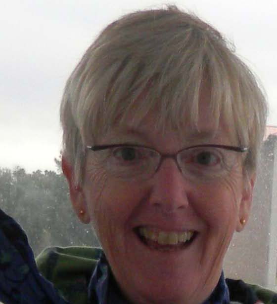
She says: It is so nice out here why don't we travel all the way to Charleston Harbor and cut out Wrightsville Beach, Myrtle Beach and Georgetown SC. It will only take 26 hrs or so......
He says; nothing, in the background he is.....
(editors note; In the boating community it is not uncommon for him to be referred to as Captain and her, to be referred to as the Admiral. I, however, never use these terms because I think they are contrite and condescending. However it is important to look at t the actions and not the words in this case.)
....on the cell phone (we are still close enough to get a signal) ...yes we can get a slip at Isle of Palms Marina but don't show up before 10-11am (yikes)and yes we can cancel our reservations to the three marinas along the ICW without any problems.
Time on phone 10 min.
He sets about to calculating the route (distance) to speeds get to the correct arrival time (distance = speed x time). There are actually three different speeds and segments that need to be calculated.
First; We will go through Frying Pan Shoals, well named,we would like to do that in the light, from our starting point to the exit way point at the of the shoal, we will go 9.3kts burning 10g/hr.
Second; From Frying Pan Shoals to the first entry buoy to Charleston Harbor traveling at 7.0kts burning 4g/hr.
Third; From Charleston harbor, adjusting for current, to Isle of Palms Marina but not adjusting for the Ben Sawyer Bridge.
She smiles; as he is totally geeked out with his gizmos, programs and calculations
Total trip 200nm and 30 hours
Time spent calculating it 20min

He thinks: why that would be great, we would save buckets of $$ by not staying at three marinas, use less fuel and get there a couple of days sooner. What is not to like?
He says finally: Sure that makes sense.
She says, smiling; fine let's do it
Total time elapsed; 35 min, way geeked out and in his own world at this point. Those USCG Captains course sure came in handy he concludes.
We begin our first off shore cruise of the season without the usual pre-trip planning of the most anal retentive type. But truth be told all of our maintenance and safety work is current and complete. We have enough fuel to go over 2,500 nm. With the exception of a Float Plan that we usually let our family know of our course and way points lat and long we are now too far off shore for cell phones to work but we are in great shape, plus we have our Spot tracker on and broadcasting ( http://share.findmespot.com/shared/faces/viewspots.jsp?glId=0YbgAe68AMPZoLxpBHQYaVI86IlerZvb3 ) note this will give only our current position.
We had heard on the marine radio several boats talking about going overnight to Charleston Harbor to take advantage of the weather window so we hailed them and joined into the group. Steadfast, Summer Ski's, Oasis, Almost Perfect and Seabright for a total of five boats making an overnight run to Charleston Harbor. We have gone overnight many times before but never with others and never in a long train. So we all coordinated our way points and communications and lined up and took off.
After all of the hub-bub is done I recall why I do not like these.
Boring! I did not plan on this so I did not have my usual audio book and I cannot read a book, ohh motion sickness, I will try to busy myself as best I can for a long run of 30 hours.More on this later...
We share watches of 3hrs on 3hrs off and at night 2hrs on 2hrs off.....but in reality I do not sleep well.I have a hard time staying away form the pilot house or fly bridge, depending on where we are running from and as a result I have a hard time turning it off when it is time to sleep.
A comment about motion sickness, if the seas kick up I can be affected. I can take medicine but do not like to do so because the side effects can be worse than the cure. What I have found is staying busy and occupied is better than just watching the instrument panel and letting my sight drift around. One of the best ways to do this especially in a dark pilot house at 3am is to listen to an audio book. This somehow keeps me focused on the book and my attention stays focused. For most people it takes about 3 days for your brain and inner ear to reorient itself to the motion. After some time on the boat going ashore still gives you the sense of motion for a time.
Jeannie however is not affected at all! Truth be told there was one episode when we were traveling to Bermuda and were in 8-10 ft seas on the bow, she was sitting in the pilot house doing a crossword puzzle and had a momentary pang of discomfort. She put the puzzle aside and immediately felt better, poor baby. By the way she is a purist and only does these puzzles in ink.
Last time I had a great audio book and was very entertained during a late night run. Jeannie lent me her IPad and I listened to Car talk with the Tappert Brothers, Click and Clack pod casts, through out my night watches...turned out to be really quite entertaining.
A brief comment on Seabright; we have an active fin stabilization system that is hydraulically driven with power take offs from each engine so the system has built in redundancy. This system also powers our bow & stern thrusters as well as the anchor windlass. At sea the active fins move to counter roll and as a result about 96% of the roll is dampened. Quite comfortable, it is made by ABT Track ( http://www.thrusters.com/products/hydraulics.shtm ) . On her own Seabright is very stable, dry and handles the waves well. Less pitching and dryer than our last boat.

The color of the water is quite different and we tried to capture the clear blue color in the prop wash

We turned north from the Charleston Harbor to go up the ICW Isle of Palms Marina which is another 5 statute miles. Saying goodbye to our new friends from the overnight run.
We have a bridge clearance of 45ft with our antenna up and 30 feet with them down. The Ben Sawyer Bridge has a clearance of 32 ft which we can clear with my antennae down and they will not lift if it is only your antenna which prevent you from going through. So we have a bit of work to do. We stopped a half mile short of the bridge and I shimmied out on the sides near the boat deck and dropped the antenna while Jeannie piloted the boat keeping her straight in the channel with a 2 kt current.

Tuesday, November 2, 2010
Alligator River; Turn & Bump

Conditions are constantly changing as weather wind and tides have their way. But there are sections of the the waterway that have developed a "reputation". The one pictured here on our electronic chart is a great example. Typically the ICW route is highlighted by way of a "magenta line". Boaters of all types follow it, in some cases to a fault.
On this passage from Albemarle Sound to the Alligator River it can be tricky for the unaware.
On the chart is a jag & turn to the starboard when traveling south as you can see from the green 7 to the white channel. The problem with this course is the water is very shallow down to 3 ft or less. Ouch! On the chart I put in a short course that went straight, marker to marker. Traveling north last Spring and again recently, two boats (each time, one a motor and the other a sail) had run aground.
Later that same day at markers 35 on the Alligator River there were large tree trunks in the water. These are called "deadheads" and if you bump one it would ruin your day. Always best in these waters to keep a good watch.
You can see a white caption box which gives the details of the hazard, this is available on Active Captain; http://www.activecaptain.com/X.php . We also use computer based software for our chart plotter called Maxsea; http://comen.maxsea.fr/maxsea/ . An excellent program.
Thursday, October 28, 2010
Pulling up anchor
For as much fun as anchoring can be, there is a dark, smelly and dirty side.
To start with, the rule of thumb in how much scope to put out (scope is meant in this case chain or rope you set out) is 5-7 ft of chain for every one foot of depth. Our depth at the North Pungo River was 10-12 ft so the rule would imply that we deploy 70-84ft of chain plus the height from the water line to the anchor roller on the bow which adds an additional 8ft.
For us the chain acts as a safety measure. In the event the anchor breaks free the weight of the chain will pull down on the flukes and reset......We typically deploy about 110-120 ft of chain as an additional safety measure. As an aside we put out snubber lines. These are 2 ropes that attach with a connector to the chain on one end and then tie off to the boat through 2 hauser holes port & starboard. The reason to do this is to transfer the stress of the chain to the snubbers and off the anchor windlass. The windlass is not built to take the pressure of the chain snapping when the wind blows or when currents tug. Snubbers act then as load transfer shock absorbers. For completeness we have a large Rocna anchor, which is 121lbs. Our windlass is upgraded to vertical Maxwwell 4000 with a band brake, which is hydraulically powered.
So..the dark and dirty side you ask? Pulling it all up and hosing it off as it comes aboard after sitting in the muck. The north Pungo River has great holding, in that our anchor buries itself into the bottom and does not budge. But it is black, smelly, oozy mud.
We set up a hose on the bow and pull in 5-8 feet of chain at a time, hosing it off as we go and trying to stay out of the smelly spatter from the spray, while at the same time being aware of where the boat is and what the wind and current conditions are doing to the doing to the boat.
We control the windlass with a wired remote control and Jeannie and I wear wireless headsets. One of us is on the flybridge controlling the boat and the other is on the bow with the windlass controller in one hand and a hose in the other.
So how does this play out in real time?
He says: Ok I am going to start, you hear the sound of the windlass and hose
She says: ok do I need to do anything?
He says: damn this stuff stinks and is like black Elmer's glue, move the bow to the starboard a bit
She says okee dokee
He says: move the bow to the port....er I mean starboard, wow this stuff is a mess.
She says: nothing, being the smart lady she is
She says: you have 90 more feet to go and starts giving a 5 ft count down
He says: yuk this &^#(%@ stuff is &^^%$# awful
You get the picture.
To start with, the rule of thumb in how much scope to put out (scope is meant in this case chain or rope you set out) is 5-7 ft of chain for every one foot of depth. Our depth at the North Pungo River was 10-12 ft so the rule would imply that we deploy 70-84ft of chain plus the height from the water line to the anchor roller on the bow which adds an additional 8ft.
For us the chain acts as a safety measure. In the event the anchor breaks free the weight of the chain will pull down on the flukes and reset......We typically deploy about 110-120 ft of chain as an additional safety measure. As an aside we put out snubber lines. These are 2 ropes that attach with a connector to the chain on one end and then tie off to the boat through 2 hauser holes port & starboard. The reason to do this is to transfer the stress of the chain to the snubbers and off the anchor windlass. The windlass is not built to take the pressure of the chain snapping when the wind blows or when currents tug. Snubbers act then as load transfer shock absorbers. For completeness we have a large Rocna anchor, which is 121lbs. Our windlass is upgraded to vertical Maxwwell 4000 with a band brake, which is hydraulically powered.
So..the dark and dirty side you ask? Pulling it all up and hosing it off as it comes aboard after sitting in the muck. The north Pungo River has great holding, in that our anchor buries itself into the bottom and does not budge. But it is black, smelly, oozy mud.
We set up a hose on the bow and pull in 5-8 feet of chain at a time, hosing it off as we go and trying to stay out of the smelly spatter from the spray, while at the same time being aware of where the boat is and what the wind and current conditions are doing to the doing to the boat.
We control the windlass with a wired remote control and Jeannie and I wear wireless headsets. One of us is on the flybridge controlling the boat and the other is on the bow with the windlass controller in one hand and a hose in the other.
So how does this play out in real time?
He says: Ok I am going to start, you hear the sound of the windlass and hose
She says: ok do I need to do anything?
He says: damn this stuff stinks and is like black Elmer's glue, move the bow to the starboard a bit
She says okee dokee
He says: move the bow to the port....er I mean starboard, wow this stuff is a mess.
She says: nothing, being the smart lady she is
She says: you have 90 more feet to go and starts giving a 5 ft count down
He says: yuk this &^#(%@ stuff is &^^%$# awful
You get the picture.
Tuesday, October 26, 2010
The good Life at Coinjock NC


We love fresh wild caught shrimp so it is always fun when we start seeing the shrimping fleet. This ole girl we saw last year.


Monday, October 25, 2010
And they are off
This is the boating snow bird season and, like in the past, this fall does not disappoint. Many many boats are headed south and the flock is certainly raring to go.
 This is the official start point. The ICW begins at red marker 36; mile zero. There are 5 bridges and one lock which, with the exception of one bridge, will open either on the hour or half hour. The typical start time is to be at the first bridge for the first opening: 8:30am (closed during rush hour) opening and plan on traveling in a group from bridge to bridge. There were 6 motor boats and 6 sail boats in the group we traveled with. A group behind us had 18 boats.
 Norfolk and Portsmouth are quite industrial and support both large commercial shipping and the US Navy, quite the sight.
 Near our home on Indian Creek in Kilmarnock Va, there is a grain silo for shipping the local farming crops, mostly soy beans and field corn. It is a common sight to see tugs and barges coming in empty and leaving full. This is where they go. If you look closely you can see a Purdue logo and two barges
 The Great Bridge Lock is always so interesting. We have gone through it with commercial vessels but today it was all pleasure craft. Normally we like to tie up on the starboard side because it has rubber side rails, the port side is just cement walls. With the crowd on this day the lock staff put us on the port/cement wall side. We put fenders out and went through without an issue.
Here is the starboard view

 Here is a beautiful old wooden boat most likely a Trumpy. I think these are such classics and would love to own one but the upkeep is never ending.


Here is the starboard view


Tuesday, October 19, 2010


We headed out this am at first light. It was cloudy and overcast so we were a bit late departing. We had the current and tide in our favor so we made excellent time traveling on average 9.5kts. Tonight we are in Tidewater Yacht marina in Portsmouth Va ( http://www.tyamarina.com/ ). We are on the T-head of F dock so an easy departure tomorrow am. We will travel to Coinjock NC passing through many bridges and the Great Bridge Lock. You can check out this u-tube video of the lock http://www.youtube.com/watch?v=qRyu54m6qt4
Tomorrow our trip to bridges, locks and Coinjock NC
Where has the summer gone
Where has the summer gone, I mean really.
It was only yesterday we had arrived home in Kilmarnock Va with a big list of things that needed to be done. Now we are talking of heading south again next week. The summer days seemed to melt one day into the next. It was certainly hot enough, now it is pleasant and comfortable. It seemed we had no real hard deadlines and plenty of time to do things and now we are working to get things ready, while it is great, it is mentally jarring!
Backing up and putting events into perspective we had a wonderful summer. It was H-O-T and humid, maybe I am getting older but it seemed to be worse than normal. Since Katie and Max announced their engagement and the wedding to be in our back yard, it was a call to action. So for 6 weeks early in the morning, Jeannie and I were out in the yard planting, hoeing and in general working to make things perfect. But boy what a drought, half the time was spent keeping plants alive. All in all we did ok but it was a lot of good healthy work.
We became member of the Virginia Yacht Club ( http://sites.google.com/site/vayachtclub/ ) which is a fun group in the Chesapeake Bay cruising club. We had a blast and met a lot of new friends and traveled a bit in the bay in-between home chores.
Our plans have changed a bit this year. We had originally planned to travel to the Bahamas but scaled that back because of the wedding and our youngest son, Johnny is in his Sr year of college and is an acting major at Washington and Lee University. We wanted to be within reasonable striking distance for performances and to work at home when needed on the house/yard. So we decided to winter in Charleston SC. Not terribly warm in the winter but not too bad and a way cool city. It is one of our favorites.
Now the summer is over. We had thought we would head south in mid November after a number of family commitments were over and we voted in early November. Jeannie noticed that we have a brief 2 week calendar break starting next week and why not head out sooner get the boat to some place further down the waterway and travel in warmer weather. The Charleston City Marina ( http://www.charlestoncitymarina.com/ ) has a winter special with reduced rates and is in the center of town. We will be there for four months starting in December. We decided to travel to Isle of Palms for the month of November( http://www.iop.net/Community/IOPMarina.aspx ) To do this there is a bunch of things that needed to be sorted out.
Prior to leaving we went into hyper drive to complete a number of home projects. We have had erosion along part of our shore line so after many months of permitting approvals we rip rapped 154' along the south facing shore. Our big unplanned (ouch) project was to replace our dock. The old one was 23 yrs old and the pilings were so bad that it was becoming dangerous. So out with the old and in with the new. This time we added tide slides ( http://www.tideslide.com/indexr.htm ) to help manage the tide surges with various storms.
So as the yard work completed we have departed south today on Tuesday October 19th and hope to arrive in Isle of Palms Sc on the 26th.
Pictures and notes to follow. Check out our track on the SPOT link
It was only yesterday we had arrived home in Kilmarnock Va with a big list of things that needed to be done. Now we are talking of heading south again next week. The summer days seemed to melt one day into the next. It was certainly hot enough, now it is pleasant and comfortable. It seemed we had no real hard deadlines and plenty of time to do things and now we are working to get things ready, while it is great, it is mentally jarring!
Backing up and putting events into perspective we had a wonderful summer. It was H-O-T and humid, maybe I am getting older but it seemed to be worse than normal. Since Katie and Max announced their engagement and the wedding to be in our back yard, it was a call to action. So for 6 weeks early in the morning, Jeannie and I were out in the yard planting, hoeing and in general working to make things perfect. But boy what a drought, half the time was spent keeping plants alive. All in all we did ok but it was a lot of good healthy work.
We became member of the Virginia Yacht Club ( http://sites.google.com/site/vayachtclub/ ) which is a fun group in the Chesapeake Bay cruising club. We had a blast and met a lot of new friends and traveled a bit in the bay in-between home chores.
Our plans have changed a bit this year. We had originally planned to travel to the Bahamas but scaled that back because of the wedding and our youngest son, Johnny is in his Sr year of college and is an acting major at Washington and Lee University. We wanted to be within reasonable striking distance for performances and to work at home when needed on the house/yard. So we decided to winter in Charleston SC. Not terribly warm in the winter but not too bad and a way cool city. It is one of our favorites.
Now the summer is over. We had thought we would head south in mid November after a number of family commitments were over and we voted in early November. Jeannie noticed that we have a brief 2 week calendar break starting next week and why not head out sooner get the boat to some place further down the waterway and travel in warmer weather. The Charleston City Marina ( http://www.charlestoncitymarina.com/ ) has a winter special with reduced rates and is in the center of town. We will be there for four months starting in December. We decided to travel to Isle of Palms for the month of November( http://www.iop.net/Community/IOPMarina.aspx ) To do this there is a bunch of things that needed to be sorted out.
Prior to leaving we went into hyper drive to complete a number of home projects. We have had erosion along part of our shore line so after many months of permitting approvals we rip rapped 154' along the south facing shore. Our big unplanned (ouch) project was to replace our dock. The old one was 23 yrs old and the pilings were so bad that it was becoming dangerous. So out with the old and in with the new. This time we added tide slides ( http://www.tideslide.com/indexr.htm ) to help manage the tide surges with various storms.
So as the yard work completed we have departed south today on Tuesday October 19th and hope to arrive in Isle of Palms Sc on the 26th.
Pictures and notes to follow. Check out our track on the SPOT link
Subscribe to:
Posts (Atom)